
25FS_IIT01: AR Viewer for QField/QGIS
Integrating Augmented Reality into Mobile GIS to improve spatial understanding in the field.
This project shows how spatial data can be brought into the real world using Augmented Reality in QField. Our prototype displays vector data like points, polygons, and 3D underground objects through Unity on smartphones and AR headsets. The goal is to help people in the field make better decisions by showing clear and interactive geographic data in real time.
Initial situation
QField is a powerful open-source mobile GIS app that allows geospatial data to be accessed and edited in the field. However, it is currently limited to 2D maps. In complex spatial contexts like construction, underground utilities, or urban terrain, this restricts how effectively users can interpret spatial relationships.
While an early prototype AR plugin exists, it only used GPS data, lacked real image recognition, and wasn’t truly integrated into QField’s architecture. This provided a weak basis to build a fully functional AR experience.
Problem statement / Project goal
While QField enables advanced geospatial workflows on mobile devices, it lacks immersive 3D capabilities. Visualizing spatial relationships like underground infrastructure or complex surface features is limited by its 2D view. This makes it difficult for users in the field to clearly understand and interpret data that is tied to a specific location.
The aim of this project was to explore how Augmented Reality can extend QField’s utility by integrating immersive 3D visualization directly into the application environment, enabling users to experience vector data such as points, lines, and polygons as physical elements anchored in the real world.
The research was guided by two central questions:
- How can different GIS elements be visualized in AR for various form factors?
- How can AR features be integrated into the current QField tech-stack/application?
Geo Pins
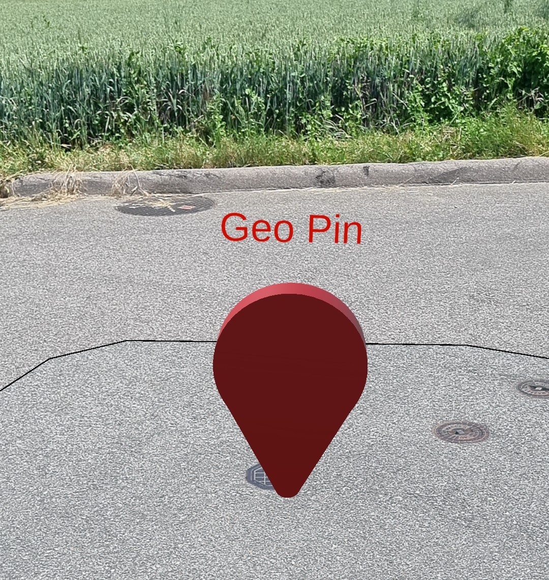
Field markers shown as virtual pins using exact GPS or world-anchored coordinates.
Underground Pipes
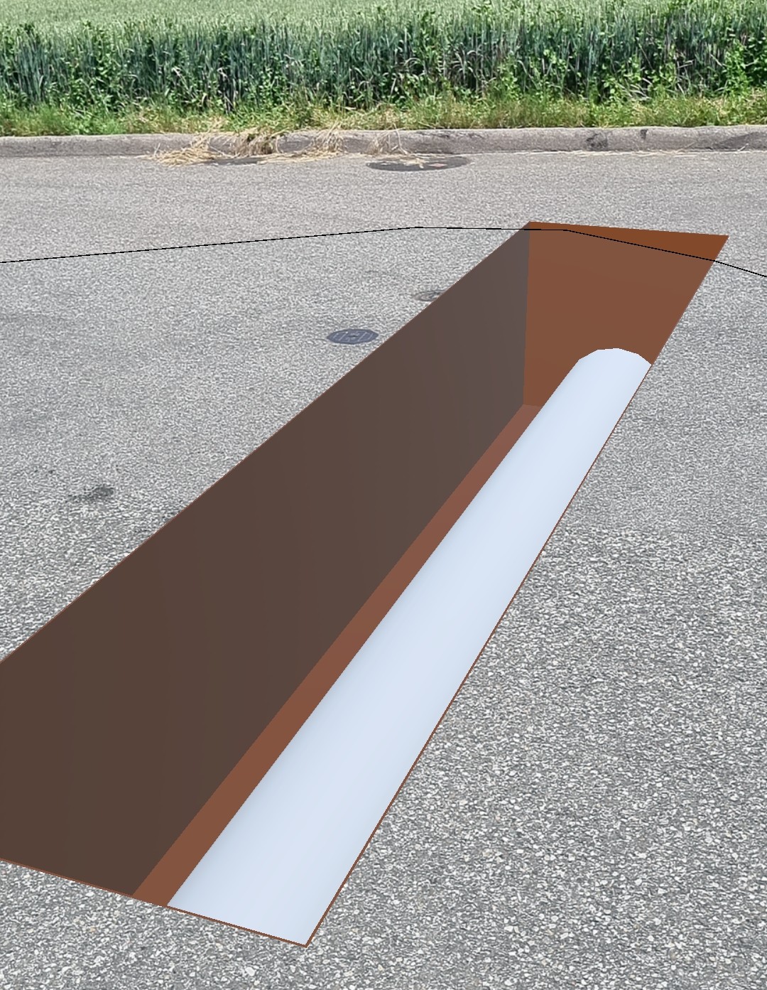
3D pipe structures rendered with transparency and spatial cues to illustrate underground utilities.
Polygons
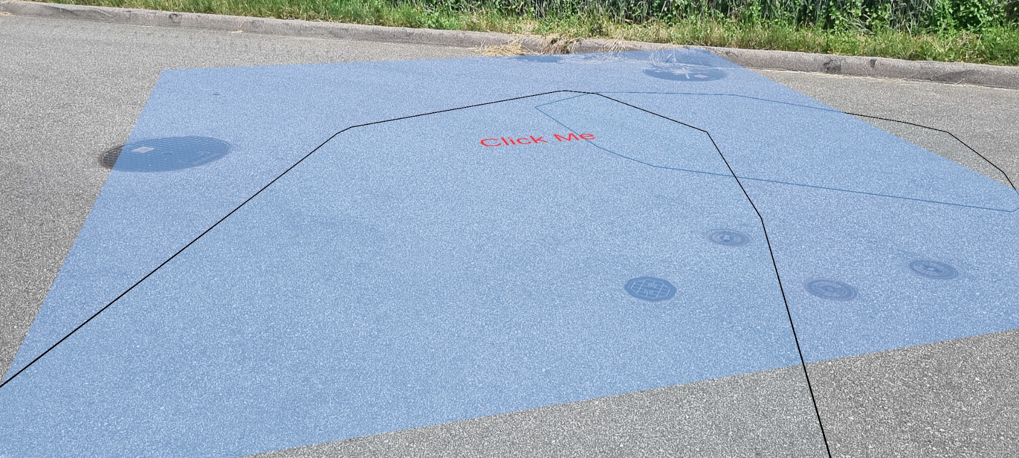
Surface areas and zones visualized in their real position, helping orient users and indicate boundaries.
Solution developed and its benefits
The final prototype consists of a standalone AR application built with Unity that reads GIS data exported from QField. The application parses geometry types (points, polygons, lines) and visualizes them as 3D objects using ARCore or ARKit. Objects are positioned using WGS84 coordinates converted into Unity world space and adjusted for elevation and scale. The system works with AR on smartphones as well as with the Meta Quest 3 headset.
Multiple visual cues were tested: color-coded outlines for polygons, transparent rendering for underground pipes, and dynamic scaling for markers depending on user distance. The app includes interaction logic and supports anchoring features using either GPS or static coordinate input.
- Supports fieldworkers with intuitive spatial overlays
- Improves depth perception for underground infrastructure
- Enhances data validation and verification during on-site visits
- Can be integrated modularly into QField's existing workflows
Technologies
- Unity
- ARCore / ARKit
- Meta Quest 3
- QField & QGIS
- Android SDK
- NASA-TLX & SUS (usability evaluation)
Key terms
- AR (Augmented Reality)Overlaying virtual elements into the physical world in real time
- QFieldMobile GIS tool that extends QGIS functionality to smartphones and tablets
- UnityCross-platform game engine used to build AR experiences
- ARCore / ARKitAugmented Reality SDKs from Google and Apple
- Meta QuestAR/VR headset enabling immersive spatial visualization
- Spatial AnchoringPositioning virtual objects persistently in physical space
Customer
OPENGIS.ch GmbH
Specialists in open-source GIS technologies, maintainers of QField.
https://opengis.ch
Team & Advisors
Team: Louis Devillers & Moritz Würth
Advisors:
Prof. Dr. Anton Fedosov
Luca Fluri