
We made a web application that makes the creation of incident plans fast and easy. It is possible to create, review and publish created plans, to make them available for incidents that the fire brigade is responsible for.
| Target Platform: | Web application |
| Data Base: | Docker, Spring Boot |
| Code Language: | Java, JavaScript, TypeScript |
| Framework: | Material-UI, React |
| Tools: | GitLab, Maven, SonarQube, Jira, Confluence, GeoAdmin |
Incident plans are standardised documents that describe important characteristics of a site or a building like access ways, who to alert, information about animals or chemicals etc. The Fire Brigade Rohrdorf currently creates incident plans manually with Power Point and Word. This makes the process tedious and slow. Our solution aims to improve the management of incident plans by providing a central application that is easy to use, so that everyone involved can fulfill the tasks. The Incident Management Platform is developed in strong collaboration with the client to ensure that the Fire Brigade has a tool that fits their needs.
The fire brigade Rohrdorf currently maintains incident plans as a set of documents in a folder. The standards of the plan-format defined by the municipality are followed with a template. Action- or access-maps are drawn on screenshots and included in the file. Map screenshots are usually taken from AGIS, the map API of the Kanton Aargau. After creation, a plan gets printed out and circulates among different entities for review and acceptance. Finally it is copied and physically stored in multiple locations - one in every fire truck, one in the command post etc.
The Incident Management Platform drastically reduces the tools involved in the creation and distribution of incident plans. Instead of Power Point or Word, the customer follows a step-by-step process in the application to fill out all required sections of an incident plan. Action maps can be drawn with the integrated map editor that uses official maps from the Swiss GeoAdmin-API. If needed, it is possible to upload and integrate third-party maps. For example site-specific architectural maps of a building can be used as a base layer for drawing. The review process is governed by the application too. A plan document can be versioned and passes through multiple states to ensure a transparent workflow. The whole incident plans repository is easy accessible from a database with search and filter functionality. And exporting incident plans as PDFs is now just a matter of clicking a download button. All information is layouted in the plan-format defined by the municipality and ready to be distributed to the fire trucks.
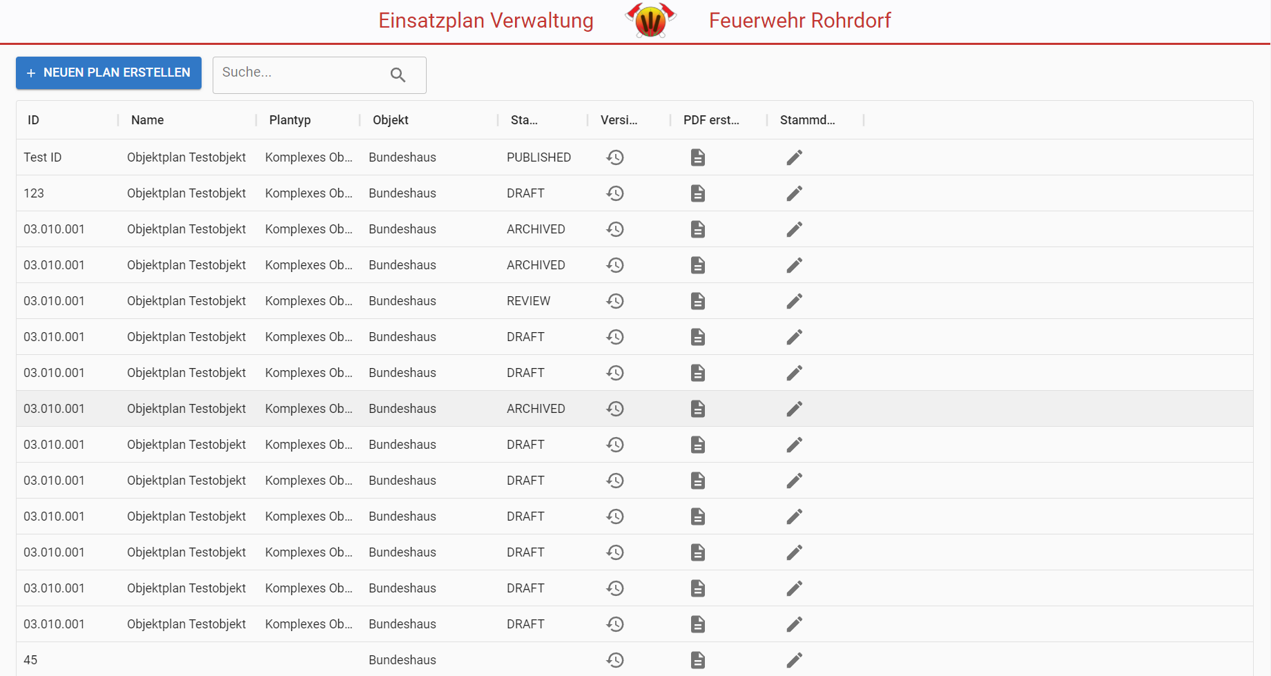
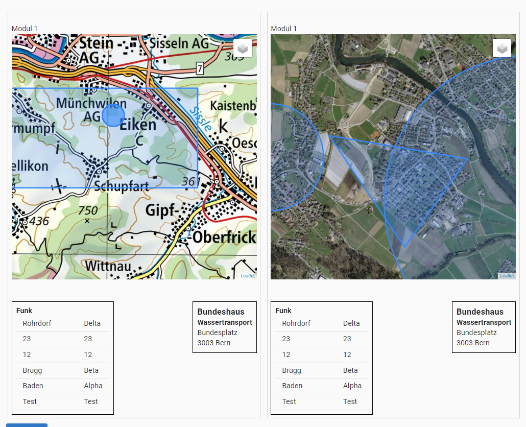
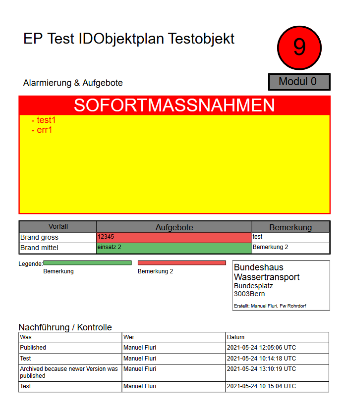
| Creation of Incident Plan | Easy Review Process |
| Integrated Map Editor | Municipality Standard Template |
| PDF Download of Plan | Plan Search with Filters |
| Duration: | 2 Semesters, 2000h Hours |
| Team Size: | 7 Students, one coach |
| Project work in 3. Semester: | Scaffold of application, Database, first implementation of plan creation |
| Project work in 4. Semester: | Implementation Map editor, finishup of UX, Usability Tests, PDF Download |
Feuerwehr Rohrdorf
Telephone: 118 (Or for a cheaper talk: Tel: +41 56 496 24 34 ¦ Fax: +41 56 496 25 94)
E-mail: kommando@feuerwehr-rohrdorf.ch
Adress:
Feuerwehr Rohrdorf
Feuerwehrlokal
Holzrütistrasse
5443 Niederrohrdorf
Homepage:
Feuerwehr Rohrdorf auf lodur| Adrian Marbot | Benjamin Leu |
| Ilja Kljajic | Jonas Volken |
| Nico Kappeler | Sebastian Grau |
| Thomas Zürcher |
Silvan Zurbrügg
